Cinque Torri Hike and Open-Air Museum
A field-tested guide to cinque torri hike and open-air museum, with honest logistics, current planning advice, and the small details that make a Dolomites trip run smoothly.
Reviewed by the Cortina Compass desk
Last verified on foot: June 2026 How we research
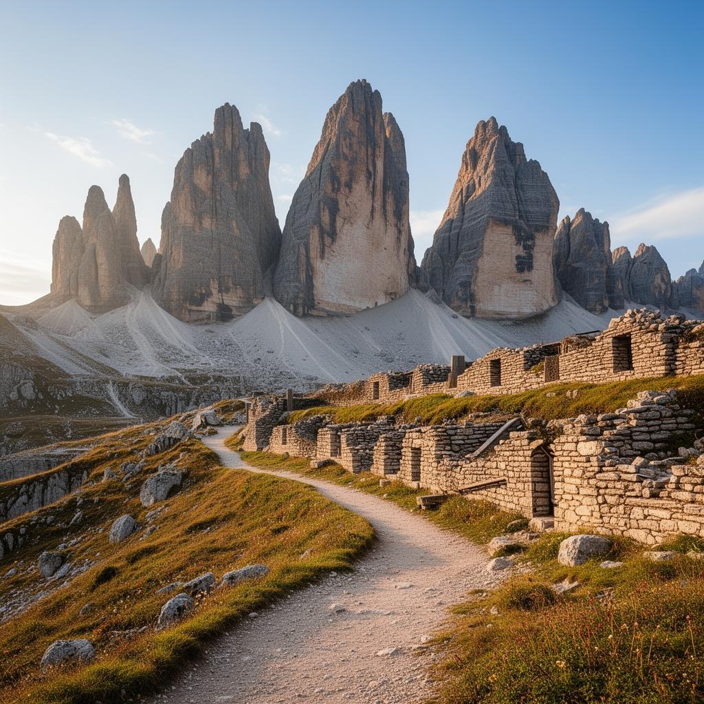
Five limestone towers, a restored front line you can walk into, and a chairlift that saves you four hundred metres of climbing. Cinque Torri is the highest ratio of landscape to effort anywhere near Cortina, and it's the walk I recommend to almost every first-timer.
A short walk with a lot inside it
The chairlift from Bai de Dones climbs to 2,255 metres in about eight minutes and puts you on open pasture with the towers directly ahead. From there the signed circuit is a gentle hour and a half, plus however long you spend reading panels — which, if you're at all interested in the mountain war, will be longer than you planned.
What the loop actually shows you
Austrian gallery, positions 1–9
Restored WWI trenches and gun emplacements dug directly into the rock.
Rifugio Scoiattoli terrace
The classic sit-down shot of the five towers with Tofana behind.
Torre Grande base
Watch climbers work the multi-pitch routes if a guided party is out.
Trail 439 descent
An easy 40-minute forest coast-out for anyone skipping the return chairlift.
Effort involved: not much
Under four kilometres and roughly 120 metres of up and down if you ride the lift both ways. Trainers are genuinely fine in dry conditions, which is not something I'd say about many walks in this valley.
The loop, and the order I'd do it in
Go left from the lift and take the Austrian gallery first, positions one through nine. They're dug straight into the rock, and the restoration work done by the local CAI section in the nineties stabilised them without tidying away the atmosphere. Some passages are still rough and low; a headtorch is worth having.
From there the path curls under Torre Grande — good odds of watching a guided party working a pitch above you — and comes round to Rifugio Scoiattoli. If you've got another forty minutes, carry on up to Averau.
Towers, trenches and terrace
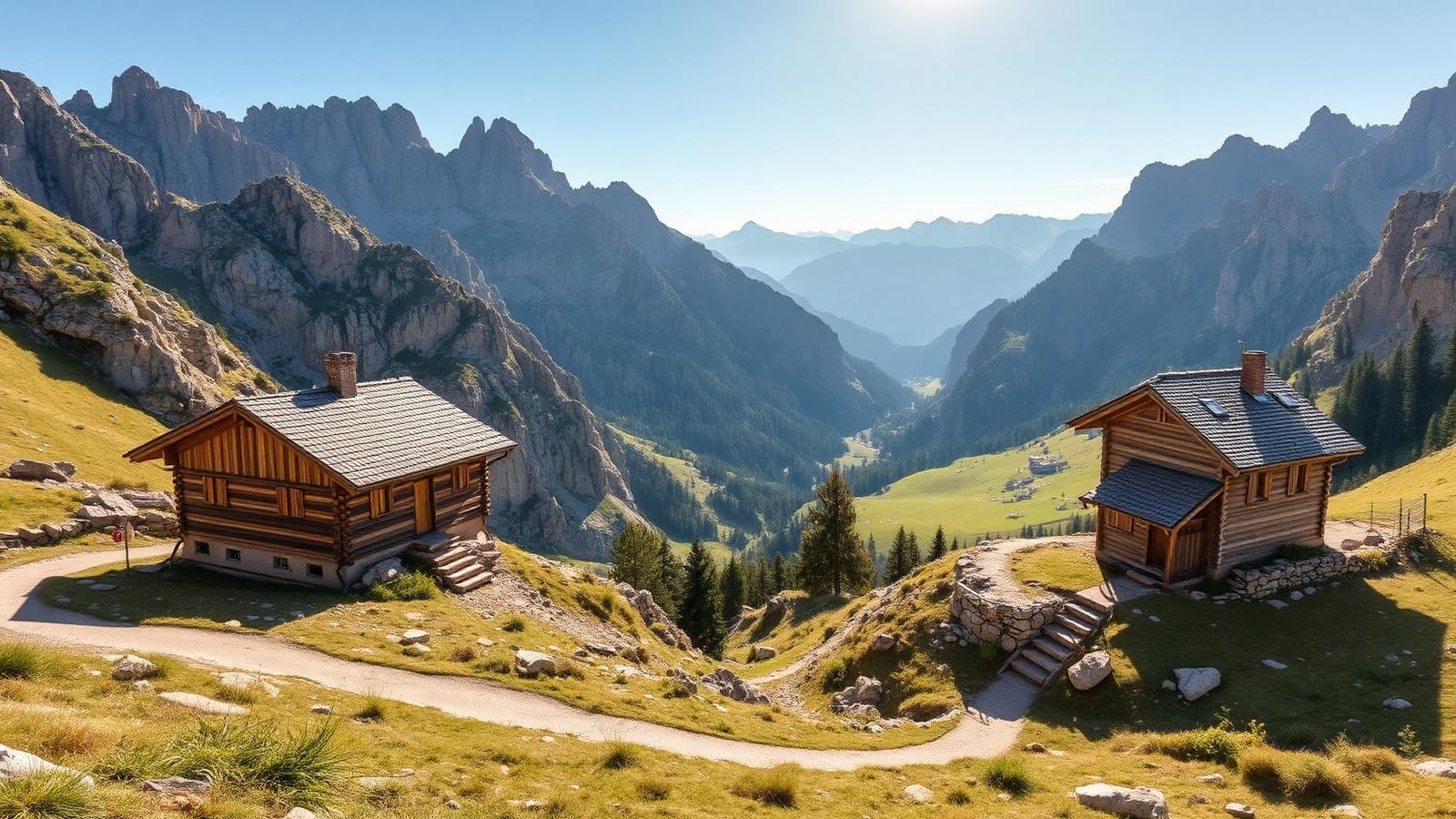
Scoiattoli's terrace is the shot everyone knows: five towers stacked with Tofana behind. Less known is the small rise behind the hut, two minutes' walk, where you get the towers with Averau and Nuvolau in the same frame and nobody's rucksack in the corner.
Weather here matters less than usual
This is the walk that survives bad weather. Cloud on the towers makes the trenches feel more like what they were, the paths stay walkable, and the huts are close. Snow can sit here into June, and the lift season runs mid-June to late September.
The galleries are unlit and uneven underfoot. Watch your head at the entrances and don't climb on the emplacement walls — some of the masonry is original and not load-bearing.
Safety note
Skip exposed ground if storms are forecast. Deciding not to continue is a normal part of walking here, not a failure.
Why I keep coming back to a three-hour walk
I've been up here perhaps a dozen times, often with visitors who don't walk much. It never disappoints them, and the reason isn't the view. It's that you can put your hand on a gun position and see, from where the gunner stood, exactly what he was aiming at across the valley. That does something no panorama does.
My tip
Take the first lift up, walk the Austrian gallery first (numbers 1-9, west side), then eat lunch on Rifugio Scoiattoli's terrace before the 12:30 crowd. Descend on foot via trail 439 for an easy 40-minute forest coast-out.
Rock that photographs itself
The towers face roughly east, so early light hits them cleanly and late afternoon leaves them in their own shadow. If you can only come in the afternoon, shoot the trenches instead — low contrast suits them better anyway.
Extending the day
Skip the return lift and walk down trail 439 through forest to Bai de Dones. It takes about forty minutes and costs you nothing. For a longer day, string Nuvolau and Averau onto the same ticket and you've got a solid five hours with two hut lunches available.
One of the few walks here where children genuinely enjoy the history. The trenches keep them occupied longer than any viewpoint.
Do not treat a cable car as a guaranteed ride home. Note the final descent before setting off.
Ride up, walk down: €14 instead of €19, and the forest descent is pleasant rather than a chore.
The Scoiattoli chairlift from Bai de Dones (1,889 m) drops you at 2,255 m in eight minutes. The full open-air museum circuit is a signed 1h30 loop with numbered panels in English, Italian and German.
A front line preserved in limestone
Between 1915 and 1917 Cinque Torri sat on the Austro-Hungarian front line facing the Italian positions on Averau; the trenches, ammunition stores and command posts open to visitors today were carved and reinforced during those two years and largely abandoned once the front shifted after Caporetto.
Restoration work by the local CAI section in the 1990s stabilised the galleries without over-tidying them, which is why some sections still feel raw rather than museum-perfect.
Frequently asked questions
Is Cinque Torri worth it in bad weather?
Yes — it's one of the few Cortina hikes that stays interesting in cloud, because the trenches and gun positions are the point as much as the views.
How much is the Scoiattoli chairlift?
€14 single, €19 return in 2026 season. Under-8s ride free with a paying adult.
Can you climb the towers themselves?
Only with a UIAA-certified guide from Guide Alpine Cortina — the towers are serious multi-pitch climbing (grades IV to VII), not scrambling.
Is the open-air museum guided?
Self-guided year-round with QR-panel audio. Guide Alpine Cortina runs 3-hour led tours on Tuesday and Friday mornings in July-August (€35 pp, book the day before).
Where should families eat here?
Rifugio Scoiattoli for the terrace view of the towers; Rifugio Averau (20 min further, 2,413 m) for a serious Ladin lunch with white tablecloths at altitude.
Three hours, one lift, a hundred years of history under your boots and a decent plate of polenta at the end. Hard to argue with.
Sources & further reading
Plan the next piece
Build a trip, not a checklist.
Pair this guide with a realistic itinerary and a place to stay near the activities you care about most.